9 Best Hiking Trails In Black Canyon of the Gunnison National Park
Going for a day hike is one of the best things to do in Black Canyon of the Gunnison. Unlike most National Parks, there are only a few trails.
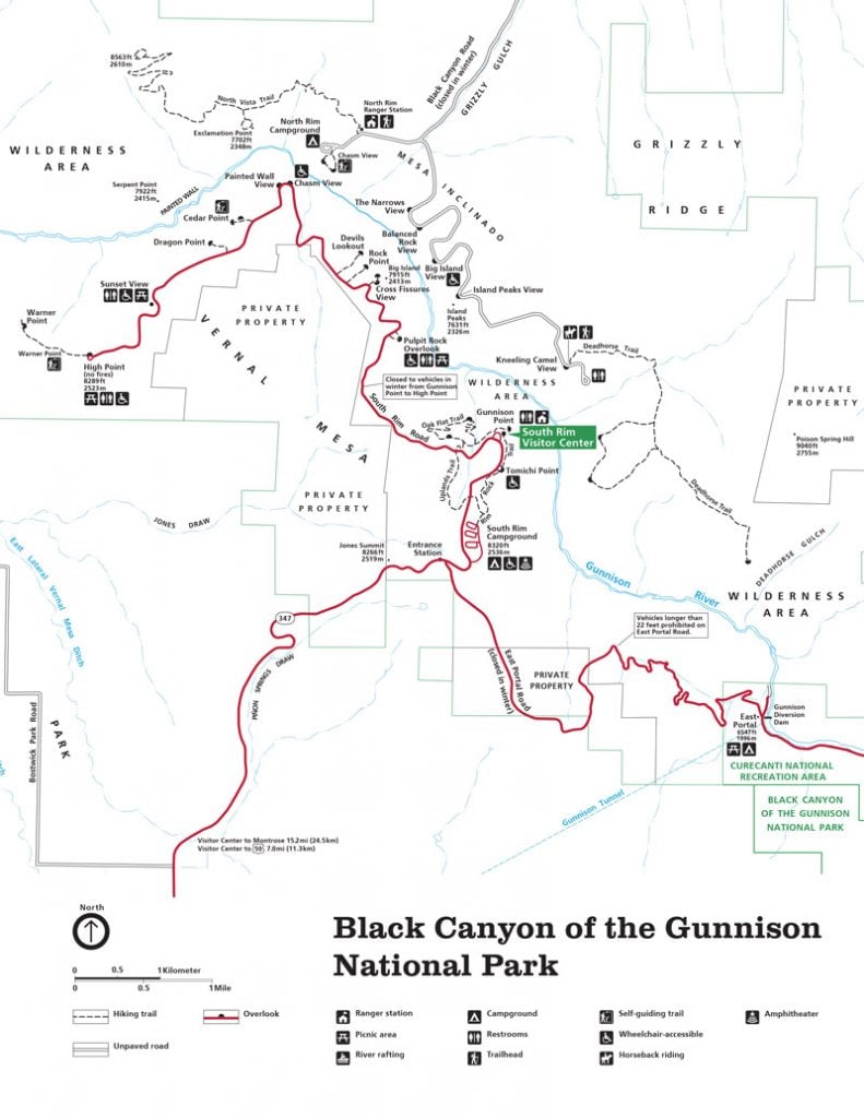
The Black Canyon hiking trails are split evenly between the North Rim and the South Rim. There are also a number of “Inner Canyon Trails” which lead all the way to the Gunnison River below.
All of the Black Canyon trails are short and sweet. They are relatively flat, and well-maintained. So this is the perfect park for visiting with kids.
In this article, we’re going to cover the best hiking trails in Black Canyon of the Gunnison National Park.
Best Hiking Trails on the South Rim
There are four hiking trails on the south rim, and one connector route. If you have the time, you can hike all of them in a single day. Below you’ll find our list of best hiking trails for views, kids, wildflowers, and variety.
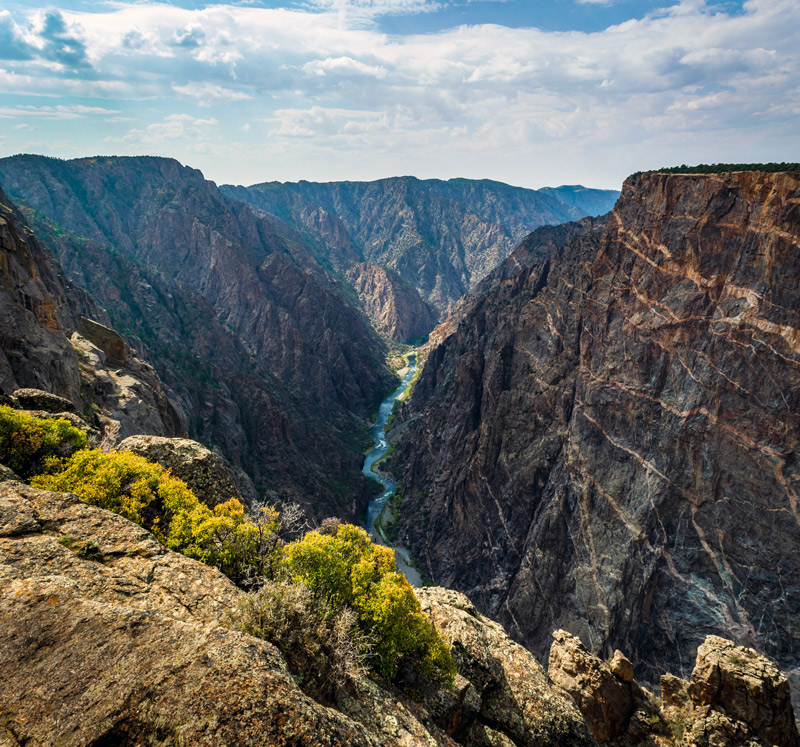
Cedar Point Nature Trail – 0.4 miles
The best views on the south rim can be found along the Cedar Point Nature Trail. The hike only takes about 10 minutes, but it’s consistently rated as one of the best places to see the Gunnison River and the famous “Painted Wall.“
The short trail is dog-friendly, and popular for viewing birds and other wildlife. We highly recommend it for families with kids because it’s short and easy to walk.
Not only does the Cedar Point Nature Trail have the best views, but it’s also our choice for the best hike to do with kids. There is a lot of signage along the trail with fun facts about the native plants.
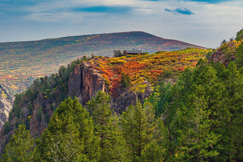
Oak Flat Trail – 2 miles
Unlike many of the other hikes on the South Rim, The Oak Flat Nature Trail has over 300 feet of elevation change! For the best hiking experience, we recommend following the route counter-clockwise so you can tackle the uphill switchbacks first then enjoy the rest of the trail.
The hike is only 2-miles long but has a lot of variety when it comes to vegetation and views. Aspen trees, Douglas Fir, Chokecherry, and Gambel Oak are just a few of the trees you’ll encounter along the way. There is also a lot of color variation if you visit during fall.
When it comes to hikes, this is our best route for variety.
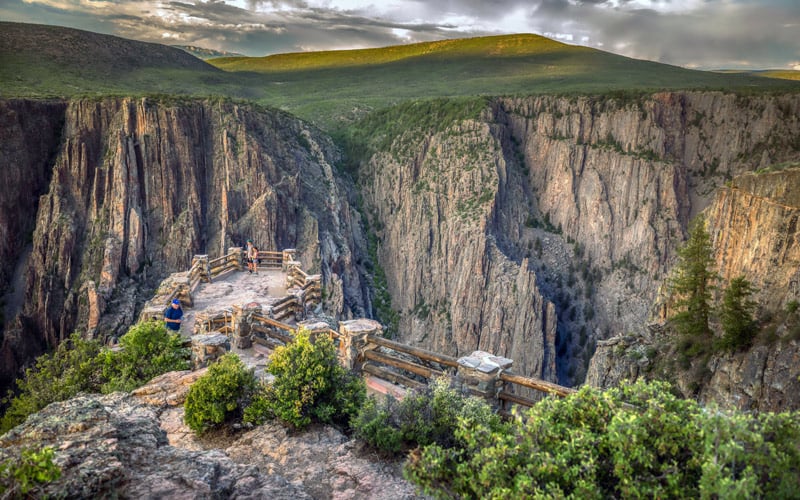
Rim Rock Nature Trail – 2 miles
The Rim Rock Trail is a point-to-point hike that goes from the South Rim Campground to the Gunnison Point Overlook next to the park’s visitor center.
Gunnison Point is consistently rated as one of the most scenic overlooks in Black Canyon so it’s one that you won’t want to miss.
The Rim Rock Nature Trail is a short route – only 2 miles. The trail is mostly flat and sunny with outstanding views of the Gunnison River along the entire path. Make sure you get out early, because this trail heats up quickly starting in late morning.
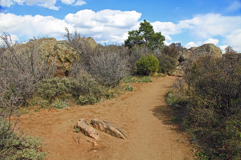
Uplands Connector Trail – 2 miles
The uplands trail leads you further from the canyon so you won’t get the sky-high views that you would with some of the other hikes. However, this is the best trail for viewing wildflowers and other vegetation. Late April and early May are the best times to see the flowers.
And, if you hike during the early morning or late evening there is a great chance that you’ll get to see the park’s wildlife as well.
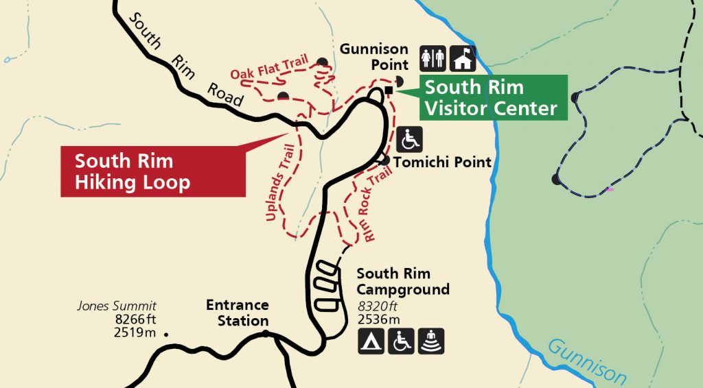
While the upland trail itself is beautiful, it can also be combined with the Rim Rock trail and Oak Flat trail to create the best long hike on the south rim.
Start from the South Rim visitor center and hike the following:
Rim Rock Nature Trail > Uplands Trail > Oak Flat Trail
The entire loop is about 4 miles long and will take roughly 2 hours to complete.
Warner Point Nature Trail – 1.5 miles
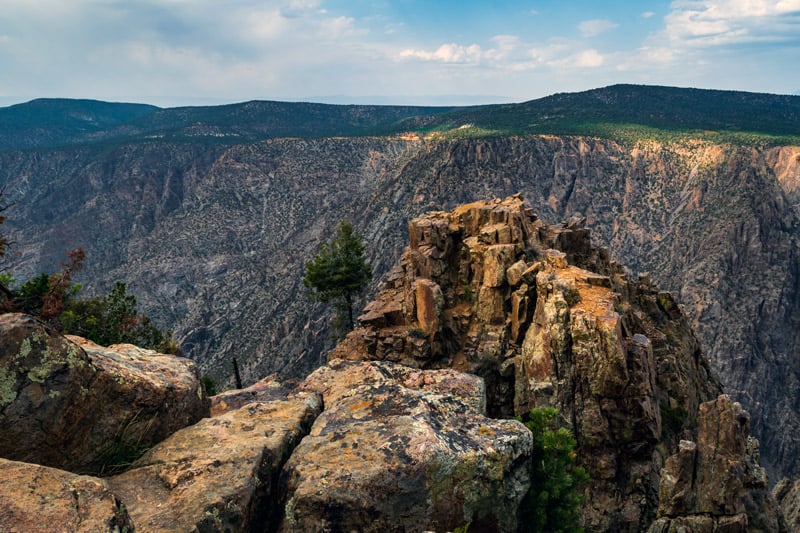
The Warner Point Nature trail is 1.5 miles round-trip and takes less than 1-hour to complete. The path has little ups and downs along the way. But it is well-maintained and has outstanding views of the San Juan Mountain Range and Uncompahgre Valley.
You’ll find shady benches along the route and an unbeatable perspective of the Gunnison River once you reach the end. The quick and easy trail wins our vote for best hike for beginners.
- For the most ambitious hikers, an inner canyon trail called the “Warner Route” begins at the the pinnacle of the Warner Point Nature Trail. The hike is 2.75 miles one-way and drops 2722 feet in elevation to the Gunnison River.
Best North Rim Hiking Trails
The hiking trails on the North Rim are quieter, and more secluded. It’s the perfect place to go for people who want to experience nature in its purest form.
Four great hikes can be found on the north rim of Black Canyon of the Gunnison. They range from 0.3 miles to 7 miles long.
Chasm View Nature Trail – 0.3 miles
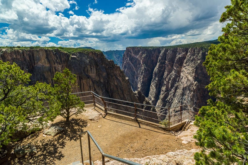
One of the most iconic features in Black Canyon of the Gunnison is the “Painted Wall.” And while there are several hikes where you can see the wall, the best hike for viewing the Painted Wall is along the Chasm View Nature Trail.
The hike is so short that most people will just consider it a quick walk, but this is one trail that cannot be missed!
Exclamation Point – 3 miles
The hikes to Exclamation Point and Green Mountain both start on the North Vista Trail. If you have the time, we highly recommend hiking the full 7 miles round-trip to Green Mountain.
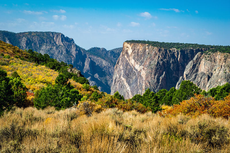
The first 1.5 miles of the North Vista Trail are mostly flat and easy. From there, pull off on the Exclamation Point Trail where the best views of the Gunnison River can be found.
From Exclamation Point you can see several overlooks and the SOB Draw inner canyon trail.
Green Mountain Hike – 7 miles
If you’re feeling ambitious, continue on the North Vista Trail to Green Mountain. This section of hike is high and beautiful. The top of Green Mountain is 8563 feet so it’s the highest hike in the park!
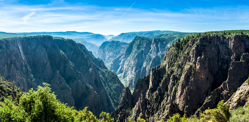
From such a high vantage point, you get the best panoramic view of black canyon.
Hikers will be able to see numerous features such as the San Juan Mountains, the West Elks, Grand Mesa, the Uncompahgre Plateau all from one spot!
Deadhorse Trail – 5 miles
Travelers in search of a remote hiking experience should look no further than the Deadhorse Trail. It’s located on the east side of the North Rim so you won’t get the scenic views, but it will certainly be a quiet experience.
This trail earns our vote for the most remote hiking trail in Black Canyon of the Gunnison.
Travelers will begin their hike at the Kneeling Camel View parking lot before heading down an old service road. This is the only trail in the park where horseback riding is permitted so you may encounter some riders along the way.
Inner Canyon Hiking Trails
One thing that many tourists are surprised to learn is that you can actually hike from the rim of the canyon all the way down to the Gunnison River below.
In fact, there are several different routes to get there!
- South Rim Inner Canyon Hikes
- Gunnison Route – 1.5 miles
- Tomichi Route – 2 miles
- Warner Route – 2.75 miles
- North Rim Inner Canyon Hikes
- SOB Draw – 1.7 miles
- Long Draw – 1.8 miles
- Slide Draw – 1.2 miles
- Devil’s Backbone Route (East Portal)
Know before you go:
The inner canyon is considered a designated wilderness area and permits are required before hiking any of these trails. The routes are generally unmarked and unmaintained so they should be hiked at your own risk.
Many travelers will choose to backpack to the base of the canyon then camp at one of the wilderness campsites along the river!
Alternatively, you can simply drive to the bottom of the canyon via East Portal Road.
Happy travels!

This Post Has 0 Comments